Emlid Reach GPS Receivers
and Data Collection Software
Emlid Banner!
Emlid: Professional-Grade and Trusted GNSS for Survey and Mapping
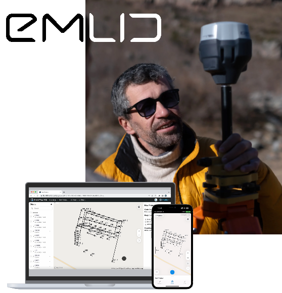
Built for real-world fieldwork in GNSS mapping for construction, surveying, GIS, and drone applications, Emlid products combine advanced positioning features with easy-to-use mobile and desktop software.
The Emlid RTK solution covers the entire field-to-office workflow: from RTK GNSS data collection to project management and integration with your CAD software.
Complete CAD Solutions partners with Emlid to promote their high-precision GNSS equipment and software.

Plug-and-play RTK GNSS Receivers
-
Centimeter-level accuracy
Multi-band GNSS with support for GPS, GLONASS, Galileo, and BeiDou. Works with CORS or a local base station. -
Field-ready devices
Easy to use out of the box. No additional training required. -
Rugged design
Waterproof and dustproof. Can operate in temperatures from –20 to +65 °C. -
Powerful built-in battery
Full-day operation on a single charge. Can be charged via a USB-C using a wall adapter or a power bank.
Choose Your Reach
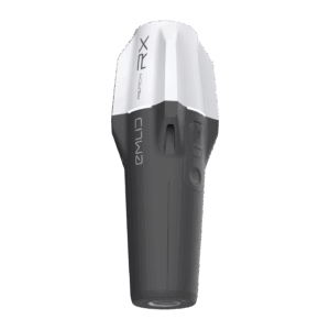
Reach RX
- Ideal for mobile crews and fast setup
- Pocket-sized & lightweight
- Works as an RTK rover
- Gets correction from any CORS or local base over NTRIP
- Pre-configured with zero chance of a wrong setup
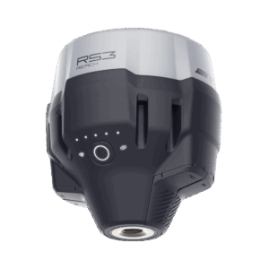
Reach RS3
- Ideal for professional surveying and site work
- Tilt compensation for precise surveying without pole leveling
- RTK and PPK support
- Acts as a base or a rover
- Connectivity via NTRIP, LoRa, and UHF radio
Most orders arrive in 3-5 days, and support is available when you need it to keep your projects moving.
Complete CAD Solutions doesn’t sell these products directly, but you can order Reach receivers on the Emlid store through this link. Use coupon code “COMPLETE” for a discount.
Emlid Flow and Flow 360
Designed for use with Reach receivers, it offers real-time coordinate capture, point coding and linework right in the field.
Emlid Flow 360 is the browser-based companion that lets you manage survey data, code libraries and projects from the office. Together, they streamline field-to-office workflows and keep your data synced across devices.
Both tools are free to use, with optional Flow subscription features available for advanced productivity.
Emlid Studio is a free desktop application for PPK processing, drone survey software integration and GNSS data correction.
Field-Ready Tools for Every Job on Site
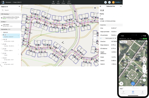
Emlid’s professional survey software, combined with Reach GNSS receivers, is designed for real-world surveying scenarios. From quick stakeouts to complex point collection across difficult terrain, Emlid Flow on your mobile device provides powerful GNSS capabilities right at your fingertips.
Design layout
Topo survey
Earthwork
Boundary survey
Field-to-Office Workflow with Emlid Flow and Flow 360
Designed for use with Reach receivers, it offers real-time surveying and layout with centimeter precision right in the field.
Emlid Flow 360 is the browser-based companion that lets you manage survey projects from the office. Flow 360 connects everything in the cloud in real-time to manage field data, track progress, and export deliverables.
Together, Emlid Flow and Flow 360 streamline field-to-office workflows, provide data fully compatible with CAD, and keep your data synced across devices and team members. Both tools for land surveyors are free to use, with an additional Survey Plan subscription that unlocks advanced features.
Emlid Studio software is a free desktop application for post-processing (PPK) of drone surveys or terrestrial GNSS data.

Whether it's Reach receivers in the field, or Flow and Studio in the office, Emlid makes surveying simple
Emlid Flow and Flow 360
Designed for use with Reach receivers, it offers real-time coordinate capture, point coding and linework right in the field.
Emlid Flow 360 is the browser-based companion that lets you manage survey data, code libraries and projects from the office. Together, they streamline field-to-office workflows and keep your data synced across devices.
Both tools are free to use, with optional Flow subscription features available for advanced productivity.
Emlid Studio is a free desktop application for PPK processing, drone survey software integration and GNSS data correction.
What You Need to Run Emlid Survey Software: Compatibility & Requirements
Emlid Flow (Mobile App)
- Supported operating systems: Android 7.0 or higher, iOS 14.0 or higher
- Devices: Smartphones or tablets with Bluetooth connectivity and internet access
- Storage: Minimum 100 MB free space
- Processor: Dual-core 2.0 GHz or faster
- User account: Emlid account required for cloud synchronization and project management
Emlid Studio (Desktop Software)
- Operating systems: Windows 10 or later, macOS 10.15 or later
- RAM: Minimum 4 GB (8 GB recommended for heavy data processing)
- Storage: At least 500 MB for software installation, additional space for project files
- Processor: 64-bit dual-core or higher
- Official Emlid reseller with verified products
- Personalized product guidance tailored to your workflow
- Custom solutions designed for your surveying and construction needs
- Competitive pricing and flexible payment plans
- Seamless integration with existing CAD and survey systems
- One-stop shop for CAD and survey software and hardware
Accurate Surveying Made Easy with Emlid Tools for Civil and Construction Projects
High-Precision GNSS Support
Achieve centimeter-level accuracy using reliable RTK and PPK workflows with Emlid GNSS receivers and land survey software.
User-Friendly Interface
Achieve centimeter-level accuracy using reliable RTK and PPK workflows with Emlid GNSS receivers and land survey software.
Streamlined Workflows
Efficient tools for data collection, stakeout and post-processing are tailored for construction sites and civil projects.
Seamless Hardware and Software Integration
Emlid Reach receivers connect easily with other GNSS equipment and third-party GIS or construction survey software, as well as CAD software.
Real-Time Data Access
Keep your team connected with instant project syncing through the Emlid Flow 360 cloud service.
Ideal for Land Surveying Tasks
Perfect for site layout, volume calculations, topographic surveys and infrastructure mapping, enabling precision on all levels.
Frequently Asked Questions (FAQs)
What is Emlid Survey Software used for?
Emlid land surveying software supports GNSS data collection, RTK/PPK surveying, stakeouts, drone data processing and post-processing for land surveyors and construction professionals.
Is Emlid Software compatible with my device?
Emlid Flow works with Reach receivers on Android and iOS smartphones and tablets. Emlid Studio PPK software runs on Windows and macOS desktops to post-process data collected with any GNSS equipment.
Do I need an internet connection to use Emlid software?
Emlid Flow works with Reach receivers on Android and iOS smartphones and tablets. Emlid Studio PPK software runs on Windows and macOS desktops to post-process data collected with any GNSS equipment.
Is training or support available when I buy from Emlid?
Yes. Emlid provides free online documentation, video tutorials and community support, along with responsive technical help through their support team.

Get 2% off on a purchase
Use coupon code: COMPLETE