

MicroSurvey embeddedCAD
Carlson Software users click here for additional discounts
MicroSurvey embeddedCAD is a powerful survey drafting software platform built with Autodesk OEM technology.This complete land survey CAD software package includes a built-in AutoCAD engine, so no separate license is required. It supports native DWG files for full compatibility with AutoCAD and Civil 3D, eliminating the need for file conversion.
Designed for land surveyors and civil engineers, the software combines COGO software, surface modeling and geodetic tools in a single, efficient workflow. With support for field-to-finish automation and integration with collector data and mapping tools, it is an ideal surveying software for Windows.
Planning to purchase multiple licenses?
Volume discounts may be available, but pricing varies by product, license type and order size.
Click Here to request a custom proposal tailored to your needs.
Purchase Includes:
MicroSurvey embeddedCAD
Premium Edition
Perpetual, Floating license
Includes a license of embedded AutoCAD (OEM)
Includes 1-year (CCP) Customer Care Package
MicroSurvey Retail Price: $5,365
All applicable discounts, including one for purchasing through our Online Store, will be shown at checkout
Description
Click here for a feature comparison chart
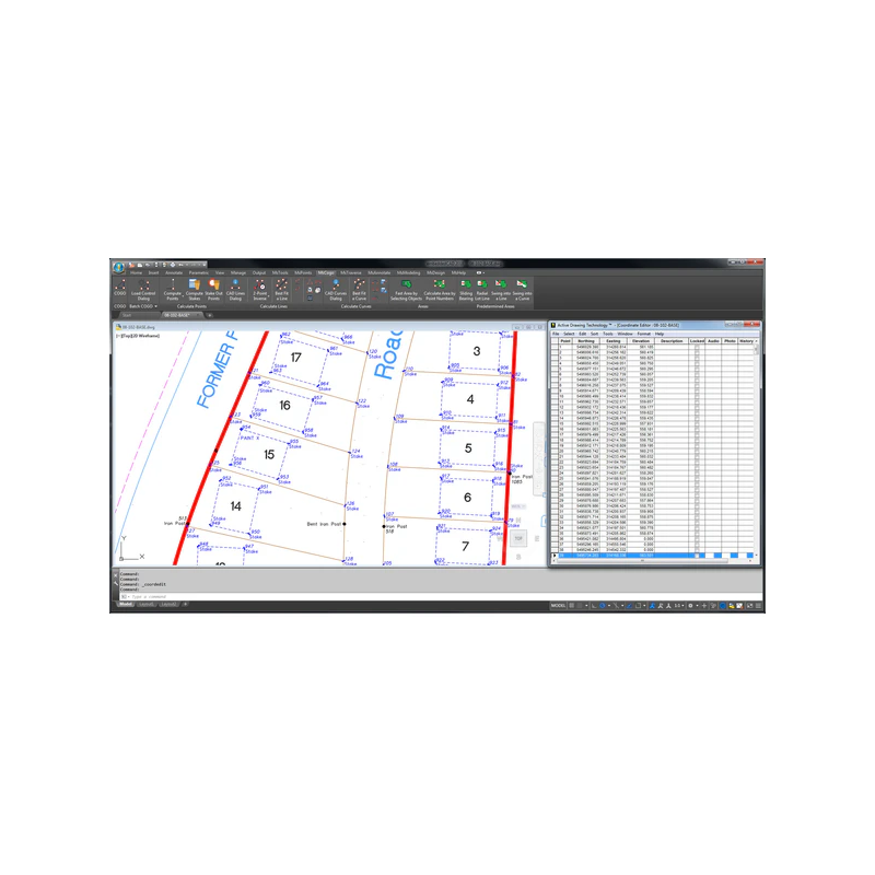
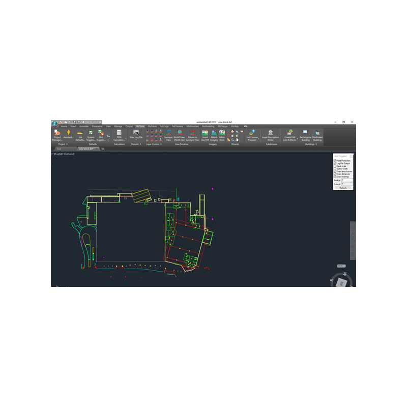
MicroSurvey embeddedCAD, developed by MicroSurvey Software Inc., part of Hexagon, is a standalone survey drafting platform built with Autodesk® OEM technology. This makes it a complete land survey CAD solution with full DWG compatibility and no need for a separate AutoCAD license. It delivers robust COGO software, field-to-finish workflows, surface modeling and integrated civil engineering CAD solutions—all within a familiar AutoCAD-style interface.
MicroSurvey embeddedCAD simplifies land development design and construction survey software workflows by combining survey computations, lot closures and geodetic tools in one powerful surveying software for Windows. It supports native DWG files, making it a highly efficient survey CAD software for teams that need to collaborate with Civil 3D or AutoCAD users without file conversion hassles. Whether you’re preparing plats, staking reports or subdivision designs, embeddedCAD has the land surveying CAD tools to get the job done right.
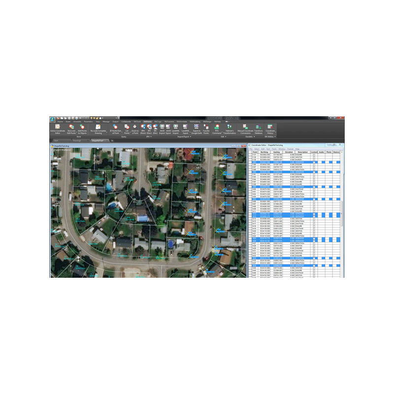
Its Premium edition includes built-in support for importing collector data, publishing to KML, generating contours, site design and advanced 3D least squares adjustment. With intuitive AutoMap linework tools and smart labeling, embeddedCAD provides everything surveyors and civil engineers need from start to finish.
Core Features
- Includes a built-in AutoCAD OEM engine—no separate license required
- Batch COGO input with automatic recording
- Traverse adjustment tools including Compass, Transit and Crandall methods
- Field to Finish diagram generation with AutoMap
- Smart editing of lines, arcs, polylines and text labels
File Format Support
- Native DWG and full Autodesk format compatibility
- Import/export support for major data collector formats
- Export to KML and integration with HXGN and Bing imagery
- Shapefile and GIS data import options
Licensing & Training
- 1-year maintenance and MicroSurvey support included
- Floating network license available
- Extensive online training resources and documentation
Related Products:
- MicroSurvey CAD: Runs embedded with a license of IntelliCAD which is included for FREE.
- MicroSurvey inCAD: Runs on top of your separately-purchased license of AutoCAD
- SurveyTools for BricsCAD: Runs on top of your separately-purchased license of BricsCAD Professional
- STAR*NET: A standalone software program for Least Squares adjustment and analysis
- FieldGenius: Field Data Collection software for Windows and Android devices
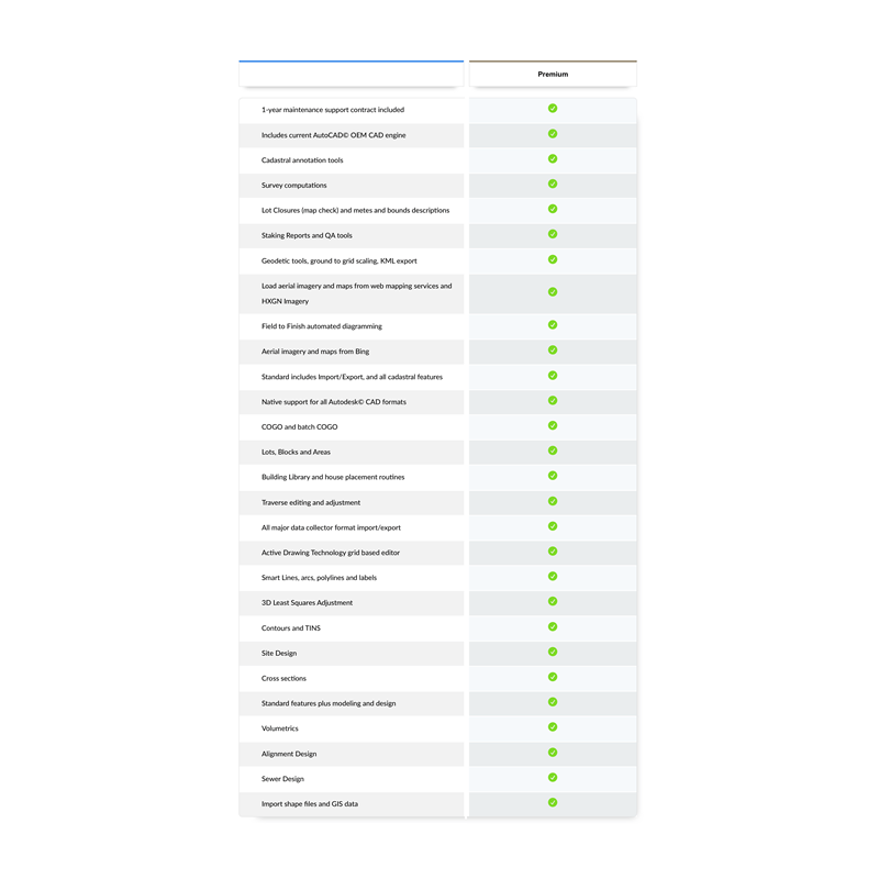
| MicroSurvey embeddedCAD (as of June 2025) |
|
|---|---|
| Feature | Premium |
| 1-year Maintenance Support Contract Included | ✔️ |
| Features a Flexible Floating Network License | ✔️ |
| Includes current AutoCAD® OEM CAD engine | ✔️ |
| Cadastral annotation tools | ✔️ |
| Survey computations | ✔️ |
| Lot Closures (map check) and metes and bounds descriptions | ✔️ |
| Staking Reports and QA tools | ✔️ |
| Geodetic tools, ground to grid scaling, KML export | ✔️ |
| Load aerial imagery and maps from web mapping services and HXGN Imagery | ✔️ |
| Field to Finish automated diagramming | ✔️ |
| Aerial imagery and maps from Bing | ✔️ |
| Standard includes Import/Export, and all cadastral features | ✔️ |
| Native support for all Autodesk® CAD formats | ✔️ |
| COGO and batch COGO | ✔️ |
| Lots, Blocks and Areas | ✔️ |
| Building Library and house placement routines | ✔️ |
| Traverse editing and adjustment | ✔️ |
| All major data collector format import/export | ✔️ |
| Active Drawing Technology grid based editor | ✔️ |
| Smart Lines, arcs, polylines and labels | ✔️ |
| 3D Least Squares Adjustment | ✔️ |
| Contours and TINS | ✔️ |
| Site Design | ✔️ |
| Cross sections | ✔️ |
| Standard features plus modeling and design | ✔️ |
| Volumetrics | ✔️ |
| Alignment Design | ✔️ |
| Sewer Design | ✔️ |
| Import shape files and GIS data | ✔️ |

Carlson’s desktop software must be installed with a CAD platform such as IntelliCAD, AutoCAD or embedded AutoCAD (OEM). Carlson Software includes a perpetual license of IntelliCAD with their “For CAD” modules but also allows users to install the program on top of your own separately purchased license of a full AutoCAD-based program such as AutoCAD, Map or Civil 3D.
Carlson Survey and Carlson Takeoff are the only 2 programs that can be purchased with an embedded AutoCAD (OEM) license.
ALL Carlson desktop products work natively in the latest DWG format. This means that you create DWG files, you open DWG files and you save DWG files – there is no need to import, export or convert to others using a different CAD-based program.
Your purchase of Carlson includes a perpetual license of the Carlson program and either IntelliCAD or embedded AutoCAD (OEM).
Carlson Software can be purchased as individual modules or by bundling 2 or more products at a discounted price so you only pay for what you need!
Carlson Civil Suite includes the Survey, Civil, Hydrology and GIS modules and compares to Autodesk Civil 3D.
Carlson CADnet is a single module that’s functionality is comparable to Autodesk Raster Design.
You can also use a Select Suite to build your own bundle of a Pick 2, Pick 3, Pick 4, Pick 5 or Pick 6 choosing from Survey, Civil, Hydrology, GIS, CADnet and Point Cloud Basic.
Carlson Takeoff Suite and Takeoff with embedded AutoCAD (OEM) is comparable to Paydirt (retired), Quest Construction and Agtek software programs.
All Carlson desktop software products provide a wide range of conversion and import and export functions for other file formats such as Civil 3d, LandXML, Topcon and Trimble.
For Carlson products that run with IntellliCAD and/or your separately purchased license of AutoCAD, Carlson offers users an Annual Maintenance program that keeps the software up to date. The purchase of Maintenance is optional and pricing is calculated at 10% of the retail price of the product per year.
Carlson Software offers free technical support from their main office to all Carlson Software users regardless of customer or license status.
Although users may find it difficult to install older Carlson desktop software on newer machines due to limitations of newer Windows operating systems, Carlson continues offering support for those versions.
Comparable to industry-standard engineering design software, Carlson Civil provides features for layer-based quantity takeoffs, 3D modeling, and construction estimating, including specialized commands like SiteNet for streamlined volume and material quantity calculations.
In addition to the functionality of the CAD-platform it’s running on top of and the identical commands available in the first 7 menus of all Carlson Desktop Software, Carlson Civil offers dynamic design and plan production for site, subdivision and roadway design engineers.
The commands and features in Carlson Civil are comparable to the engineering design components of programs such as: DCA/Softdesk/Land Desktop (retired), AutoCAD Map, Civil 3D, Eagle Point (retired), TerraModel (retired), GeoPak and InRoads.
Carlson Civil also provides users with the tools needed for layer-based quantity takeoffs and model building in the 3D Data and SiteNet menus. The commands in SiteNet are comparable to construction estimating software such as Paydirt, Quest and Agtek.
With Carlson Civil, users are able to:
- import and export data files for Civil 3d, Land Desktop, LandXML, Trimble, Topcon, Google Earth and more
- create and manage points in the drawing or in the CRD file editor
- use a variety of specialized commands to convert 2D linework to 3D using points, text with leaders, surface files, drawing entities and more
- use SiteNet, a layer-based feature that simplifies the process of estimating dirt and topsoil volumes and quantities of other materials such as subgrade volumes, length of curb and number of trees or other structures to be built or demolished
- create and manage surface model triangulation files from field data or importing from Google Earth or other sources
- view and perform quality checks on surface model files in various 3d viewers including a 3D Fly By
- calculate earthwork volumes for pads, stockpiles or between two surfaces and calculate adjustments required to balance cut and fill
- create cut/fill labels and color maps
- create and manage horizontal alignments
- create and manage profiles of ground elevations, roadways, sewer pipes and crossings
- design ditches and trenches
- calculate and report quantities and depths of pipe installation projects
- create and manage cross-sections
- dynamically design a network of roads with intersections and cul-de-sacs that automatically adjust and provide dynamic, real-time cut and fill volumes
- design and map single parcel boundaries or networks of subdivision lots that dynamically adjust to accommodate building footprint and setback restrictions.
FAQ: I’m a land surveyor. What software do I need?
FAQ: I’m a civil engineer. What software do I need?
FAQ: What are the latest improvements in Carlson Software?
FAQ: What features & menus are in Carlson Civil?
FAQ: What features & menus are in ALL Carlson Software desktop programs?
FAQs: Installation and Technical Support
All Carlson Software purchases will be fulfilled electronically by a download link that will be emailed to you (along with your new serial number) within two business days of your order being processed. The download link and serial number can be used to install and register your software immediately.
For delivery to addresses within the United States, we can also ship you a flash drive via UPS Ground for an additional charge. Please note that the physical shipment DOES NOT include manuals.
Your box shipment will arrive approximately 14 business days after your order has been processed. Be aware that software purchases outside the United States will be fulfilled by download only. If you pay the extra charge for the physical shipment we will only provide a download link and will then refund the shipping charge.
30 Day Trials
Click here to send us a message or click here to Request a Custom Proposal to see what we can do!
Related items...
Additional information
| License Term | Perpetual |
|---|---|
| License Type | Floating |
| Edition | Premium |